Followers

Monday, 15 February 2021

Cowpers Cross

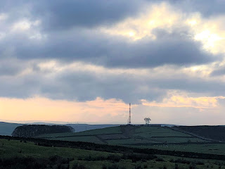
 The plan was to walk from East Morton, up to the Keighley Mast and across to the 12 Apostles on Ilkley Moor.  However when we got up to Keighley Mast and started up the path to the 12 Apostles it was Baltic, the wind was blowing a Gale and the path underfoot was treacherously icy.  So we retraced our steps and cut across to Cowpers cross (plan B was in place).  From there the path went to the Buckstones, and down a rather hairy slippery path across the boggy moorland using the wooden walkboards and into the Plantation.  We had a brief stop here for some lunch but the chill factor in the wind was taking the temperature well below zero so we didn't stop long.  As soon as you took your gloves off your fingers were frozen.  We walked on through the plantation back down the fields which were pretty ice covered and onto the main road back down to East Morton.  A good 10 mile hike which at points made you feel like you were artic explorers.


Small Stream iced over in parts looking very pretty


Cowpers Cross


A couple of images of the Buck Stones


Friday, 12 February 2021

NEW YEAR - NEW START

 Well I've been away from here for quite a while, so new year new start. Only a little late starting.

A month and a half actually.  It's now mid February 2021 and Lock down no 3.  But getting through these strange times.  So thought I needed something to get me creative again and where better than here with walking and photography.

So today it was a mean temperature of about minus 5 and the wind was raw cutting straight through you, but with working from home I really needed to get out in the fresh air for a walk.  I went down to East Morton, met up with a friend and we walked over to Riddlesden, bacl along the canal to Micklethwaite, up to the top of East Morton then back down to the village centre.  Blew the cobwebs away and beautiful clear views and a frozen canal.


Frosty Canal walk


Top of East Morton looking across to St Ives, Bingley


Sunday, 25 November 2018

Cowling Pinnacle


Mabel had slept over last night so we were doing a short Sunday morning walk. The weather was dull and overcast but when we set off it was fine.  I decided we wouldn’t park in the bottom of Cowling itself but in the small car park on Buck Stones Lane.  This made it a high level straight walk.  We set off and it was a cold wind blowing on us. 
As we got to the Pinnacle (Wainmans) we met a group of teenagers scrambling over the rocks on their motorbikes.  We stayed close to the wall edge as we walked past. 

We went through the stile and headed off to Lunds Tower. 
It definitely wasn’t getting any warmer and there was a fine drizzle starting to fall.  Even so we met lots of dog walkers who were out there although no-one was lingering to enjoy the view.  Which to be honest was deteriorating rapidly now.  We got to the tower and started up with a small torch I’d brought – it wasn’t much good so I had to use my phone torch, we didn’t go far up as it was still pretty dark and Mabel didn’t want to go any higher.  So we came back down I took a few photographs and we set off back the way we had come. 


When we got back to the car we were both pretty cold.  Mabel’s feet felt like icicles and so did my hands.  Keelham in Skipton was our next stop,  coffee for me and cake for Mabel – we had earned it.

Saturday, 24 November 2018

PinHaw Lothersdale


This is a good walk and it had stayed fine after 12 – also as the days are drawing in this may be the last weekend I get chance to bag a trig point this year. We’ll see.  Anyway I parked in the usually turning circle and walked down into the village.  As I have done this walk several times I decided to do it in reverse this time.  So I walked down the main street turning left up a steep road.  Which I quickly discovered was the wrong road.  Good start.  Then I remembered the turning I wanted was almost opposite a small mill dam.  Off I went again. 
The path was straightforward up through several fields to eventually bob out on the small road to Raygill Fisheries.  From here I turned right and onto the road out of Lothersdale uphill turning off onto a turning on the right over a small bridge to enter another set of fields.  So the long pull up to the moor tops continued. 


It was a steep trek up and up eventually going through a small plantation to arrive on the moor top.  Here I could see the trig point up ahead.  I followed a rough cart track up to the point.  The views were stunning – a lot better than I thought they were going to be, so glad I’d made the effort to walk up here today. 

Now it was a long slow gentle walk along the moor edge gradually dropping down through fields back into the village. 
I walked it a lot quicker than I thought I would too. About 4.5 miles of bracing Yorkshire air.  Never get fed up of doing this walk.  I’ll almost certainly do it again next year.


Saturday, 17 November 2018

Thornton and The Old Bell Chapel


It wasn’t too bad a day although it wasn’t a day for climbing hills and good views so the plan was to do a walk around Thornton.  I hadn’t done this walk before so that made it interesting.  I parked up in Thornton crossed the road and went down the small paved pathway – very slippy had barely got started downhill before I fell.


 It made me walk the rest of the way down the path very carefully.
The path took me across a stream and up through part of a golf course.  At the top looking back was a man in the bottom who I think was looking for a golf ball – I think he would be a long time looking.
The way was to then turn left to West Scholes – I have been here before – it’s a very pretty place just a small hamlet of really old properties.  From here I went on towards an old railway bridge (part of the Queensbury Triangle).  Going under the bridge and then left through a stile and along the valley side. 


This then led to a public road (Cockin Lane) quickly turning left onto the Bronte Way.  The way ahead then took me across a huge sloping meadow aiming towards the Church.  Eventually at the church I came out onto Bradford road to a short walk back to where I’d parked the car.  Good walk just about 4 miles. 


Saturday, 10 November 2018

The Bridestone Rocks from Lydgate


This is a pretty stiff walk up to the tops from Lydgate in the valley.  Following ancient tracks and gritstone outcrops – the views at the top are over the Cliviger Valley.
Parking up on Church Road I turned right heading underneath a large arch of a railway viaduct. 


Turning up into a field almost immediately.  This was a steep field with sheep and a couple of rams in it at the top. Here I squished through the squeeze stile pretty quickly.  


I didn’t like the look of them at all.  From here I continued up to Stoney lane 

where I turned right to come out at a rough pasture to follow a path around the hill-side before turning up a cart track


 – eventually arriving at Windy Harbour Farm and the stone sculpture – The Wizard of Whirlaw.  It looks like something from Easter Island. 


The next section was road walking to eventually take a stile off towards the Bride Stones.  The main stone (called The Bride) is impressive. 


From here I took a path heading slowly back down to Stoney Lane and down to Orchan Rocks.  The day was dulling in so I stuck to the main path back down through Kitson Wood and to the car.  

As I got to the car the rain came down so I think I struck lucky with my timing today.
All in all a good walk – maybe to do in the summer and extend it to include the Mount Cross. I think this was about 5 miles.

Sunday, 4 November 2018

Hebers Ghyll


George had stayed overnight and I’d tried to think of a walk that would interest him and not find too boring.  I thought he might like this one and it wasn’t too far to drive to the start.  We set off about 9.30 Sunday morning – arriving in Ilkley around 10 ish.  Parked up and set off – walking along the quiet roads towards the walk proper passing Heathcote on the right built by Sir Edwin Lutyens as a private residence and now offices. 

We followed the road round, past all the houses, turning up some steep steps to turn right and walk through some woods to the foot of Heber’s Ghyll. Here we took the path up alongside the stream, which crosses and re-crosses it by small wooden bridges. 


At the top is a chalybeate well. 


We went through the kissing gate onto the moor and half right up through the bracken. Here we could see the old iron railing on the cliff edge that protects the Swastika Stone.

After looking at it – it was a lot smaller than we thought it was going to be we went back to the top of Hebers Ghyll, to walk past Panorama Reservoir and along the edge of the moor. 

We crossed the road and headed over to White Wells CafĂ©  - here we looked inside the bath house which was supposed to have been used by the Victorians if they felt ill – George rightly said the walk up from Ilkley was enough to make them feel ill as it’s a steep pull up from the town.  

We then made the long walk back down to the car and headed off home for bacon sandwiches.  A good 4.5 mile which I really enjoyed with George as my walking mate.