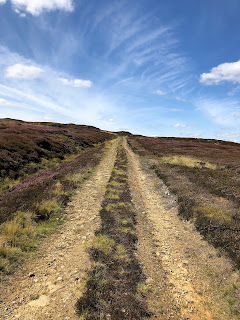
Fine sunny day and excited at the prospect of a new walk
with Gail and Monica. Monica had picked
this walk from the Bradford Council walking web site. Parked on Back Lane in Stanbury and set
off. The first part was pretty straight
forward up to Top Withins.
From here we must have taken the wrong path as we spent quite a while on the tops looking for the trig point above Delph Hill 1456 ft above sea level. From here we scanned the horizon to find the Alcomden Stones our next point of reference. Gail set off confidently while Monica and I faffed around with our maps and compass before eventually agreeing Gail had set off in the right direction. Once we reached the stones we couldn’t see any particular landmarks to guide us the right way – we again watched Gail treck off head in the air saying she thought it was this way. Here we were supposed to be following the boundary between Yorkshire and Lancashire.
Over this part of the rugged moorland we had to constantly check our direction against the compass (this is the most remote moorland in the area). It was hard work walking over the heather and tufts of grass and there were several sneaky boggy areas and hidden holes and hollows. At one point Gail went down a hole up to her thigh. She was lucky she had her walking pole with her as she scrambled out. Eventually we stopped and checked the horizon up ahead and in the distance we saw another group of walkers on the horizon where there was a slight hill – this we guessed was Crow Hill our next point and where we planned to have lunch. When we got there the walk had definitely been worth it. The views were fantastic and we were ready for a rest and our sandwiches.
We checked our OS map and we had definitely found Crow Hill. After lunch we walked easterly along the top of the moors to a large boundary stone and the stone marking the supposed grave of Lad or Scar on Crow Hill , eventually dropping down to the old Delph Hill Quarry.
From here there was a well-defined track to take us all the way back to Ponden Reservoir.
We walked along the embankment turning up the track to Buckley Green. Here there were jams and chutneys for sale we bought some and rammed them in our back packs. We were now on the home straight back to Back Lane which had filled up with cars since we set off this morning. Our final leg of the day was to call at the pub in Stanbury for a lager shandy. What a grand day out and a good 8 miles covered.


No comments:
Post a Comment